Tape Correction, Sag Correction and Pull Correction | Surveying and Levelling

Tape Correction, Sag Correction, Pull Correction and Temperature Correction

In this article, I will list out different formulas for the respective corrections…

Tape Correction

The following corrections are to be made for measurements taken with a tape because tape can never be practically used under specified standard conditions.

Correction for absolute length

Absolute length of tape is its actual length under specified condition

Ca = Lc/L

Where, Ca = correction to be applied to the tape in ‘m’

Lc = measured length in ‘m’

L = nominal length of tape in ‘m’

Correction for temperature

Length of tape is increased with the increase of temperature and decrease with decrease of temperature.

Ct = A (Tm – Ts)

Where,

A = coefficient of thermal expansion per one degree Kelvin

Tm = temperature during the measurement in Kelvin

Ts = temperature at which the tape standardised in Kelvin

Read more

Numerical Examples for Chain Surveying | Errors in Surveying

Numerical Examples for Errors in Chain Surveying

We will now move on with different numerical problems on the concept of Errors in Chain Surveying. Going through these numericals will actually give you an idea as to how the calculations are done inspite of errors occurring in the Chain Surveying.

Correction due to incorrect length of chain

This is like a formula list which is to be kept in mind while making Calculations:

True distance = L’/L*measured distance

True area = (L’/L)2*measured area

True Volume = (L’/L)3 * measured volume

Where, L’ = incorrect length of chain

L = correct length of chain

The length of a line measured with 20m chain was found to be 500m. It was subsequently found that the chain was 0.04m too long. What is the length of line?

Correct length of chain, L’ = 20 + 0.04 = 20.04m

Length, L = 20m

Read more

Errors in Chaining | Guide to Surveying and Levelling

Types of Errors occurring in Chain Surveying

There are two types of Errors that are commonly seen to occur in Chain Surveying. For students studying the concept of Chain Surveying, study of the occurrence of different types of Errors in Chain Surveying is important. In this article, we will briefly discuss different types of Errors in Chain Surveying and the situations in which they occur.

Types of Errors:

  1. Cumulative error
  2. Compensative error

Cumulative error

These errors always accumulate in one direction and are serious in nature. They affect the survey work considerably.

They make measurements too long or too short.

These errors are of two types and are known as systematic errors.

They are classified as follows:

  1. Positive error
  2. Negative error

Positive error

These errors make the measured length more than the actual length which results into wrong calculations by the Surveyor.

Read more

Methods for Calculation of Areas in Surveying | Average Ordinate Rule

Calculation of Areas in Surveying | Average Ordinate Rule

In one of my previous articles, I discussed Midpoint Ordinate Rule in detail with an example and listed out various important methods used for the calculation of areas in Surveying. In this article, we will deal with the next important method (rule) used for the calculation of areas in the field of Surveying.

Here are the five important rules (Methods) used for the calculation of areas in Surveying:

  1. Midpoint ordinate rule
  2. Average ordinate rule
  3. Simpson’s rule
  4. Trapezoidal rule
  5. Graphical rule

Average Ordinate Rule

The rule states that (to the average of all the ordinates taken at each of the division of equal length multiplies by baseline length divided by number of ordinates).

Average Ordinate Rule

O1, O2, O3, O4….On ordinate taken at each of division.

L = length of baseline

n = number of equal parts (the baseline divided)

d = common distance

Area = [(O1+ O2+ O3+ …. + On)*L]/(n+1)

Here is an example of a numerical problem regarding the calculation of areas using Average Ordinate Rule

Read more

Different Methods for the Calculation of Areas in Surveying

Different methods for the calculation of Areas in the field of Surveying

In this article, we will list out different methods to calculate the areas in Surveying and also study each of the method in depth… We will also explain each method with a suitable example for your better understanding…

Here are the five important rules (Methods) used for the calculation of areas in Surveying:

  1. Midpoint ordinate rule
  2. Average ordinate rule
  3. Simpson’s rule
  4. Trapezoidal rule
  5. Graphical rule

We will now move on with our discussion on the first rule “Midpoint ordinate rule” with a suitable example.

Midpoint-ordinate rule

The rule states that if the sum of all the ordinates taken at midpoints of each division multiplied by the length of the base line having the ordinates (9 divided by number of equal parts).

Midpoint ordinate rule | Method for calculating area in Surveying

In this, base line AB is divided into equal parts and the ordinates are measured in the midpoints of each division.

Area = ([O1 +O2 + O3 + …..+ On]*L)/n

L = length of baseline

n = number of equal parts, the baseline is divided

d = common distance between the ordinates

Example of the area calculation by midpoint ordinate rule

The following perpendicular offsets were taken at 10m interval from a survey line to an irregular boundary line. The ordinates are measured at midpoint of the division are 10, 13, 17, 16, 19, 21, 20 and 18m. Calculate the are enclosed by the midpoint ordinate rule.

Read more

Field work in Chain survey | Surveying in Civil Engineering

Field work in Chain surveying | Surveying and Levelling

Earlier, we discussed “Principles of Chain Surveying” and the considerations that are taken for carrying out Chain Surveying… In this article, we will discuss various instruments that are essential for carrying out Chain Surveying.

Here are the steps to be followed for carrying out Chain Surveying:

  1. Reconnaissance Survey
  2. Marking stations
  3. Running survey lines
  4. Taking offsets

Instruments used in Chain Survey

  1. Chain, 20m or 30m long
  2. Tape
  3. Arrows
  4. Ranging rods
  5. Wooden or Iron Pegs
  6. Plumb bob
  7. Cross staff

Chain used for Surveying

20m chain – 100 links

30m chain – 150 links

1 links – 20cm

Links of chain are made by mild steel wire – 4mm diameter.

Chain used for Chain Surveying

Each link at the end is bent into a loop and is connected to adjoiningly by means of three oval rings which offers flexibility to the chain. Ends of chains carry brass handle.

Read more

Types of Measurements in Surveying | Civil Engineering

Types of Measurements in Surveying

Surveying is the art of making suitable measurements in horizontal or vertical planes. This is one of the important subjects of civil engineering. Without taking a survey of the plot where the construction is to be carried out, the work cannot begin.

From the above definition, we conclude on two types of measurements in surveying. They are as follows:

  1. Linear measurements
  2. Angular measurements

Now we will go on with the discussion of each of these types of measurements along with their subtypes.

Linear measurements are further classified as follows:

Horizontal Distance

Vertical Distance

Horizontal Distance

A horizontal distance is measured in horizontal plane if a distance is measured along a slope, it is reduced to its horizontal equivalent.

Horizontal Angle
Horizontal Angle

Vertical Distance

A vertical distance is measured along the direction of gravity at that point. The vertical distance are measured to determine difference in elevations in various points.

Read more

Purpose of Surveying | Civil Engineering

Purpose of Surveying in the field of Civil Engineering

  • To determine the relative positions of the existing futures of the ground.
  • To layout our marked positions of proposed structures on the ground.
Surveying | Land Survey
  • To determine areas, volumes and other related quantities.
  • To prepare a map of a country of detailed out location of cities, towns, villages and major roads.
  • To prepare the engineering detailed plans and sections of various sections such as roads, railways, bridges, dams and other structure.
  • To prepare a topographical map showing details of hills, valleys and rivers.

Scales used in Surveying | Engineering Surveys

Scales | Engineering Surveying

Scale is a fixed ratio that every distance on the plan bears with corresponding distance on the ground.

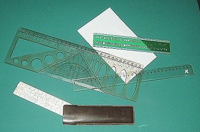
Rulers bearing a certain specific scale for measurement

Scale can be represented by the following method

One centimetre on the plan represents some whole number of the metres on the ground.

1cm = 10m

This type of scale is called engineering scale.

1 unit of length on the plan represents some number of same units of length on the ground.

1/1000 etc…

This ratio of map distance to the corresponding ground distance independent of units of measurement is called Representative Factor (RF).

For example,

1cm = 50m

RF = 1/(50×100) = 1/5000

Above two types of scales are also known as numerical scales.

Read more

Classification of Surveys according to their field of Work | Engineering Surveying

Classification of Surveys according to the field of work | Surveying and Levelling

In one of my previous articles regarding “Classification of Surveys“, discussion of various types of surveys have been listed out. We are now proceeding with the detail study of different types of surveys under the category of field of work.

The classification for the field of work is as follows:

Land Survey

This involved survey of objects in earth’s surface.

German Soldier carrying out Land Survey to determine the natural features and determine areas of strategic importance

Read more