Chaining on Sloping Ground | Guide to Surveying and Levelling

Chaining on Sloping Ground | Surveying and Levelling

There are two methods for determining horizontal distance on sloping ground.

  1. Direct Method
  2. Indirect Method

Direct Method of Chain Surveying

This method is also known as “Stepping Method”.

The horizontal distances are directly measured by the process of stepping.

Procedure

A path of chain or tape is stretched out from ‘P’.

The path length of chain or tape depends on the steepness of the ground.

The follower holds the zero end of the chain at ‘P’ and directs the leader at P1 to be in the line of PQ and stretch the chain or tape above the ground in horizontal line.

Direct Method | Chain Surveying

The leader then transfers the point ‘P1’ to P2 on the ground by means of plumb bob or dropping a pebble or an arrow,

Now the followers take the new position ‘P2’ and directs the leader to move forward and stretch the tape or chain in a line of PQ.

Now the followers take the new position ‘P2’ and directs the leader to move forward and stretch the tape or chain in a line of PQ and the new position is P3.

Again the leader transfers the point P3 to P4 on the ground as done earlier.

This process is repeated till the point Q is reached.

Horizontal distance PQ = S1 + S2 + S3 + S4 + S5
Read more

Classification of Surveys and Surveying Methods in Engineering

Classification of Survey

Study of classification of surveys is a major part of the study of Surveying as a whole. The surveys are conducted using various different instruments. The use of instruments depend upon its availability and suitability to the site.

Surveys are classified as following:

  1. According to the instruments used for the survey
  2. According to the purpose of the survey
  3. According to the method employed for the survey
  4. According to the field of work

In this article, we will list out the classification in each and category and study them in detail…

According to the instruments used

Chain Survey

Chain Survey is conducted using different lengths of chains specifically made for the surveying purpose.

Compass Survey

As the name itself suggests, the compass is used for the purpose of the survey.

Plane table Survey

Plane table is used for the purpose.

Levelling

Theodolite Survey

Theodolite is an instrument that is useful for conducting accurate surveys.

Read more

Introduction to Surveying | Civil Engineering

Surveying

Surveying is the art of making suitable measurements in horizontal or vertical planes. This is one of the important subjects of civil engineering. Without taking a survey of the plot where the construction is to be carried out, the work cannot begin.

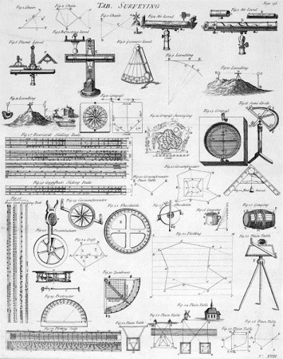
Surveying Chart
Surveying Chart

Levelling

Levelling is the art of representing relative positions in the vertical plane of different points on the earth’s surface.

It helps in determining the areas that are to be levelled to achieve a certain slope.

Principles of Surveying

All the surveys that are conducted are based on two fundamental principles. They are as follows:

  1. Working from whole to part
  2. Fixing a point with reference to two fixed points

Working from whole to part

In order to localize errors and prevent their accumulation, a set of control points is always established with great precision first for the whole area to be surveyed.

Later on, details or filled in between these control points to a relatively smaller precision.

This fundamental work principle is known as “Working from whole to part”.

Fixing a point with reference to two fixed points

Survey stations are fixed by atleast two measurements, either both linear or angular measurements or linear and angular measurements from two control points.

Read more